


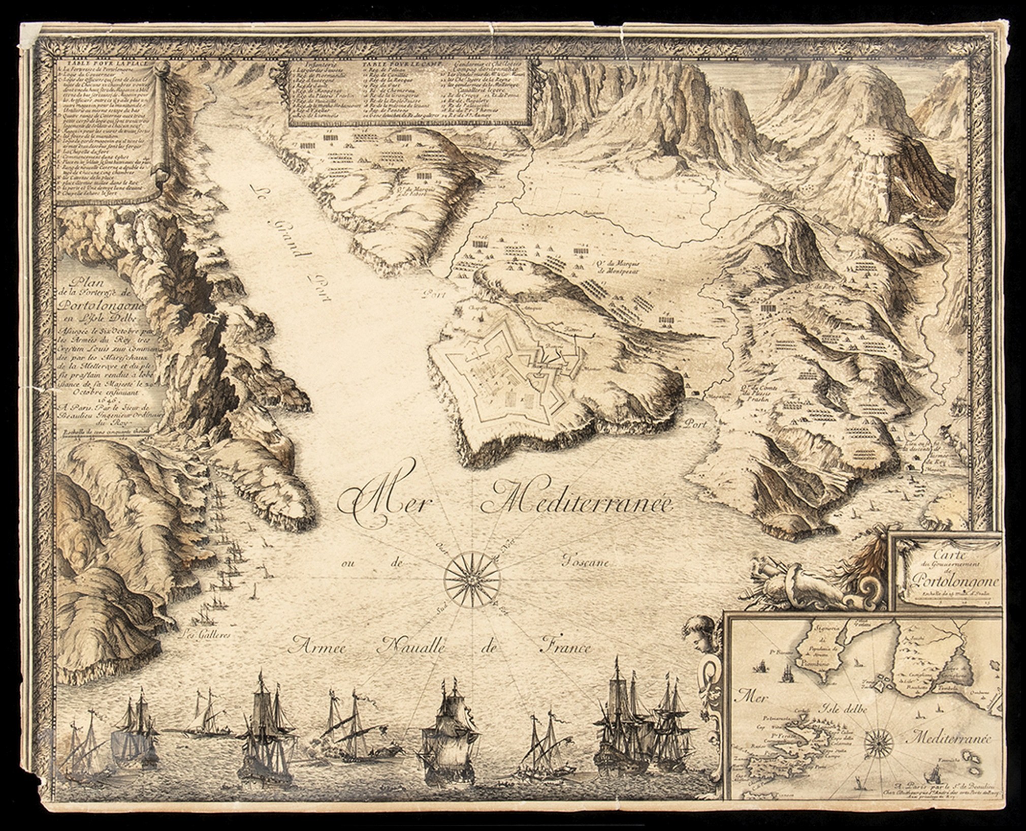
Sébastien Pontault de Beaulieu (1612–1674)
Carte du Gouvernement de Portolongone ( Porto Azzurro - Isola d'Elba)
etching, 55 x 44 cm
from "Le glorieuses conquistes de Louis le Grand, Roy de France", printed in Paris, 1659 ca. Plan of the Fortress with nautical chart of the Port and coastal profile, above indications on the formation of the army during the siege of 1646, below sailing ships during the naval battle, together with a small geographical map of the Island of Elba.
Interesting map, trimmed at the edge of the engraved decorative frame, heavy paper with restorations and some missing edges.


最近瀏覽過的
登錄以查看拍品列表
收藏
登錄以查看拍品列表